In Ancient times, western Indian ports played a vital role in trade and commerce. Among the important ports of the Early Christian era were the ports of Sopara, Kalyan, Chaul, Mandad etc. that are mentioned in the Periplus of the Erythraean Sea as well as in various cave inscriptions of Maharashtra.
Among these ports, the ancient port site of Nalasopara, which is located in Vasai Taluka, Thane district, was one the chief ports of Western cost and was known as the Suparaka or Supparak. It is mentioned in Mahabharata as one of the important places in the Aparanta Region. Sopara is the only port in Western India where an Ashokan edict has been found. This indicates that this port was an important link between the coastal area and the plateau area possibly to trap the resources of the plateau hinterland. This port might have also acted as a centre for long-distance trade between Sopara and Southern Arabia, Red Sea, Egypt and hence it probably became an important trade centre during the Mauryan Period.
It is clearly evident from the archaeological and literary sources that Sopara remained the main cultural, religious and economic centre for centuries dating from the pre-Ashokan period up to the 3rd century A.D. and again from 6th to 13th century A.D., as well as thereafter till 17th Century when Portuguese traded with India. The main cause for the decline of the ancient port of Sopara is not clearly known, however experts think that the siltation of the area might be one of the important reasons for its decline. The important issues pertaining to the dawn, evolution and decline of the site could be only addressed with the help of near-shore archaeological exploration assisted by scientific techniques of prospecting and mapping.
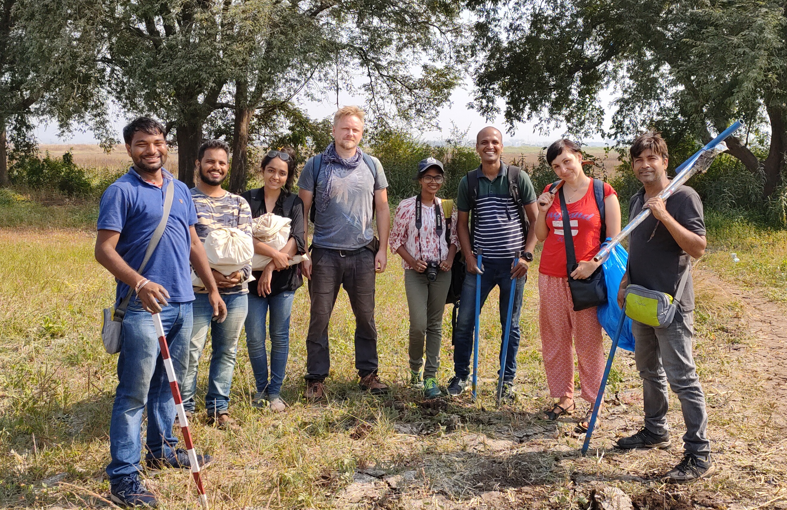
In this connection, the INHCRF and the University of Warsaw have signed an MoU for collaborative projects. Under this, the first Indo-Polish exploration was undertaken during January 2020 to explore Nalasopara, a port of great antiquity. The Polish team was led by Dr. Emilia Smagur with Andrzej Romanowski as the second member. INHCRF was represented by Dr. Riza Abbas (Project Director) and Sitaram Toraskar.
The main aims of this exploratory project for 2019-20 were: to identify the archaeological potential of the site, to prepare a detailed map of an archaeological landscape of Sopara, to ascertain geomorphological aspects as well as the distinctiveness and nature of site borders, to look at the long-term development of Sopara from the earliest period and to map and define the site characteristics based on archaeological findings.
Through this survey programme, documentation and mapping of archaeological sites was conducted with the help of GIS application, GPS, digital imageries, topographical, sheets and old maps. New sites were identified by conducting systematic exploration and survey using local geomorphological understanding, a study of satellite imageries, old maps and oral tradition.
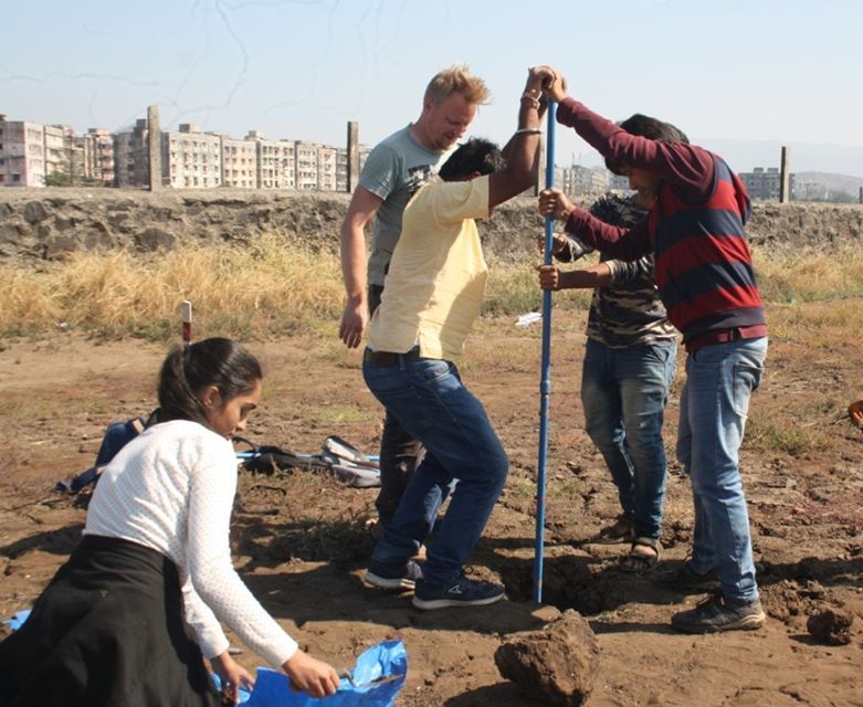
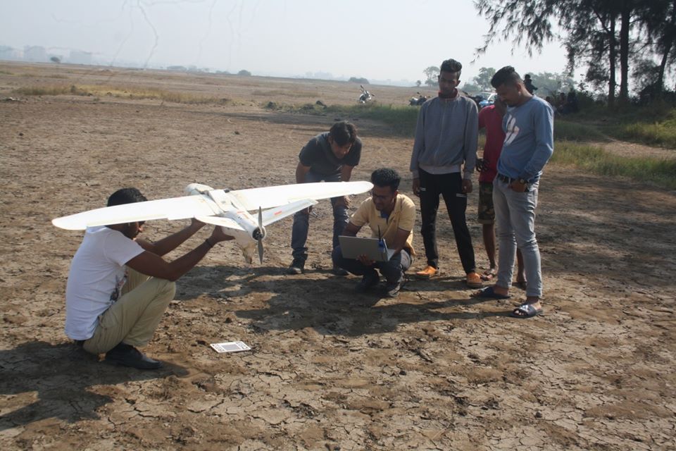
Scientific sampling strategies for understanding the density and distribution of artefacts was also applied. Ergonomic hand auger was applied for sampling of various types of soils and sediments to understand the thickness and extent of archaeological sites as well as to develop local geomorphology of the area. In order to acquire DEM, DSM, Ortho Images, multispectral 5band images etc., for site documentation, mapping, photogrammetry and to detect buried archaeological features, a drone survey was conducted in more than four square km at the site of Sopara. In addition to this portable metal detector for finding the metallic objects was also used.
During this survey programme other than visiting the previously discovered sites, a systematic survey was organised using geomorphological information, resources, maps and satellite imageries. Different landforms such as elevated areas/ridges, lake banks, agricultural areas (with varying soil types), estuarine areas, tidal flat zones as well as local creeks were explored using GIS applications as well as old maps and reports. Large tracts of land in and around Nalasopara were explored by the team and as a result all known sites viz., mounds/sculptural/architectural sites were documented. The team discovered, documented and mapped new habitation sites/scatter areas that were previously not reported. During this survey programme a good site distribution map (especially along the palaeochannels) was prepared and geomorphological data on the palaeochannel network, details of various landforms, ancient settlement patterns, modification of landscape by natural and anthropogenic factors was gathered. In order to carry out scientific analysis, a systematic collection of artifacts from selected areas for further classification and study was conducted. In addition to this soil profiles from 17 different localities was collected for geomorphological, micro and macro floral and faunal studies. Digital Terrain Model, High Resolution RGB Image, 5 Band Multispectral Image, and contour map of the site acquired during the Drone Survey
Preliminary geomorphological studies and archaeological data suggests that all the ancient, as well as present settlements around Nalasopara, are located on series of crescent-shaped elevated mounds or ridges that are separated by curved shallow depressions (runnels) that are formed between two successive beach ridges spaced at regular intervals parallel to the shoreline. The Palaeochannel network is found in between these depressions. At the site of Nalasopara levees of palaeochannels and stable mudflat areas (presently 0.5 m below the present sea level) were occupied for establishing settlements during the ancient period. The estuarine Port site of Sopara was once located on an estuary (which has now converted to mudflat) possibly towards the SE fringe of the site.
This exploration programme led to the discovery of coins, stone, terracotta, glass and metal objects. Other than the antiquities, pottery of different periods, ring well fragments and Satavahana bricks were also recovered at different locations. Stone alignments, brick and stone walls as well as stone anchors were also discovered during this survey programme.
In the first field season through survey programme we became successful in assessing the archeological potential of site as well as in creating a small database of artefacts, maps, antiquities, Ariel RGB maps, Thermal maps as well as detailed data on the soil profiles of various locations and on the built and architectural heritage of the area. This will immensely help for conducting future research in the area. The study of antiquities and soil samples is underway and is expected to be completed soon.
Being the first systematic and scientific attempt to understand the site composition, as well as archeological and architectural remains of Sopara, the data collected during this year’s survey programme may lead to the future detailed scientific study of this port site next year (2020-21).
It was a proud moment for both the teams as this will lead to further bonding of the archaeological activities between the two Institutes and countries.
INHCRF is thankful to ASI for granting us Exploration permission; Indrone Services, Mumbai,
for conducting the UAV survey; Management of INHCRF, Nashik and University of Warsaw; Maharashtra Police Department and to Local Residents of Nalasopara, specially Mr. Swapnil Meher of Sea King Resorts. We are thankful to our team members Falak Chaudhary, Sujitha Pillay, Dhanajay and Sachin Sule for their invaluable assistance. Special thanks to Mr. Siddhart Kale; Drs. Suraj Pandit; Pabodh Shirrwalkar and V. Shobha for visiting the site and sharing with us their valuable observations and knowledge.